GIS & Technology
ARRO is a leader in Geographic Information Systems (GIS) technologies.
For decades, ARRO has provided state-of-the-art GIS solutions to diversified organizations of all shapes and sizes. Whether it’s implementing an automated data management system, creating a tool to model a utility network, or using cutting-edge data technology to locate features in the field, ARRO provides innovative solutions tailored to each client’s unique needs.
Over the years, ARRO has evolved from a provider of GIS services into a trusted partner in innovation. That growth stems from our close connection with our clients—their needs, insights, and ambitions drive the progress behind every solution we deliver.
What sets us apart from the competition?
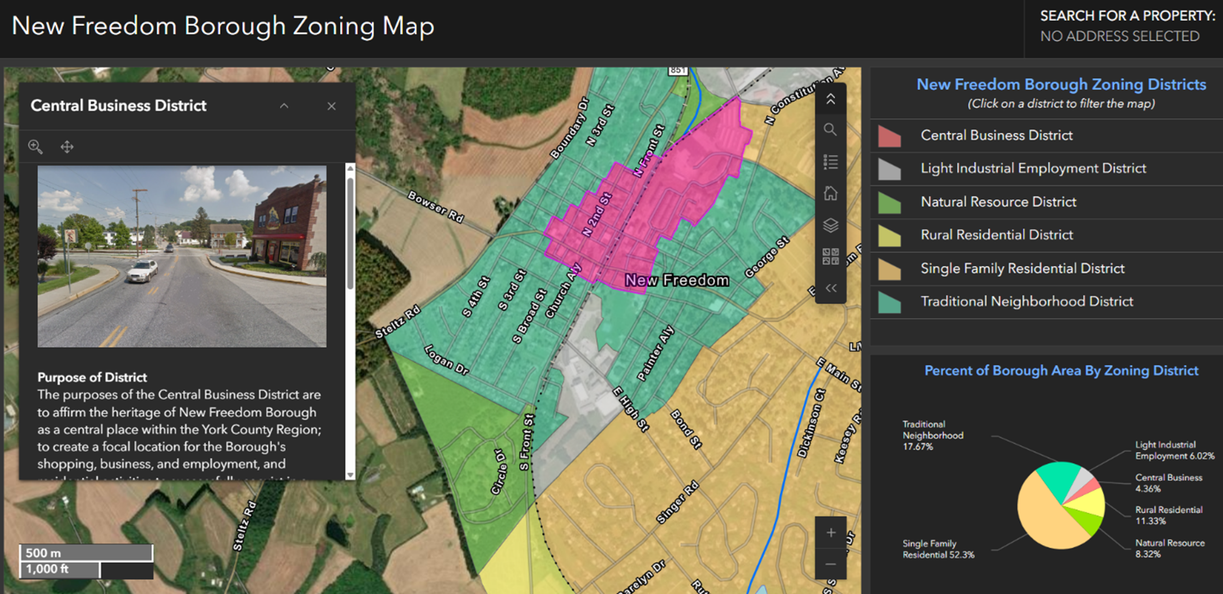
We don't just do maps. We create systems that move communities forward.
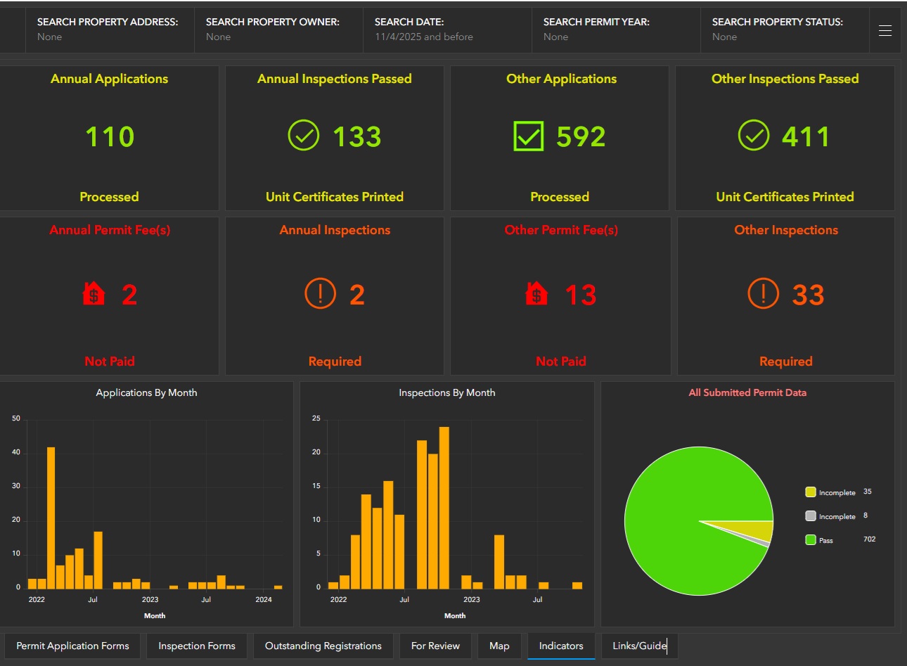
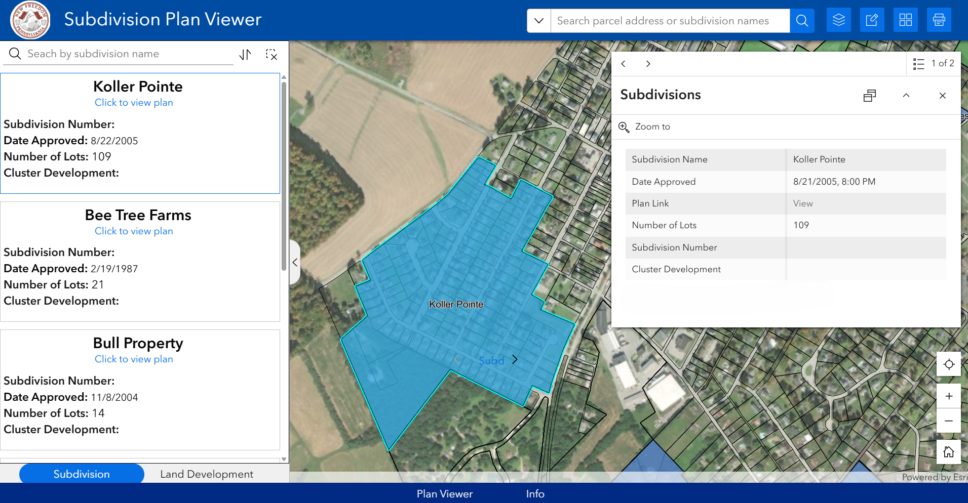
ARRO has a dedicated team within our organization - ARROtrac - that not only supports all technical services and groups within ARRO, but also delivers automated, customized GIS solutions that empower clients to make smarter, faster, and more informed decisions. Combining technical expertise with real-world understanding of municipal and infrastructure needs, ARROtrac transforms raw data into actionable insights through streamlined workflows, automation, and intuitive visualization tools.
From asset management to field data collection and reporting, ARROtrac delivers tailored GIS systems that integrate seamlessly with each client’s operations—saving time, improving accuracy, and enhancing transparency. Whether supporting utilities, public works, or environmental management, the ARROtrac team ensures every solution is built to evolve with the community it serves.